Start: Cheakamus Lake Trailhead 844m
Turnaround/Camp: Helm Creek Campground 1498m
Finish: Cheakamus Lake Trailhead 844m
Route: Cheakamus Lake Trail, Helm Creek Trail
Distance: 16.32km return
Elevation Gain: 728m
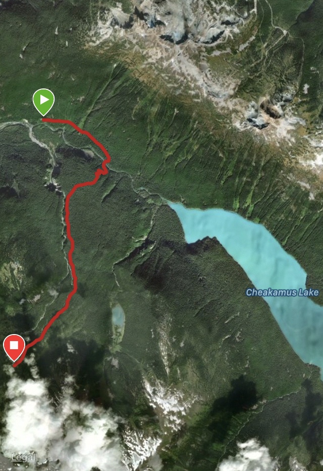
Notables: Head E off HWY #99 at the lights in Function Junction S of Whistler. Turn L on Cheakamus Lake Rd before the bridge crossing Cheakamus River. Stay on this road for 7.5km until it terminates at the parking lot and Trailhead. There is an outhouse at the trailhead. The parking lot tends to be busy so don’t leave valuables in your car and do leave room for others to park.
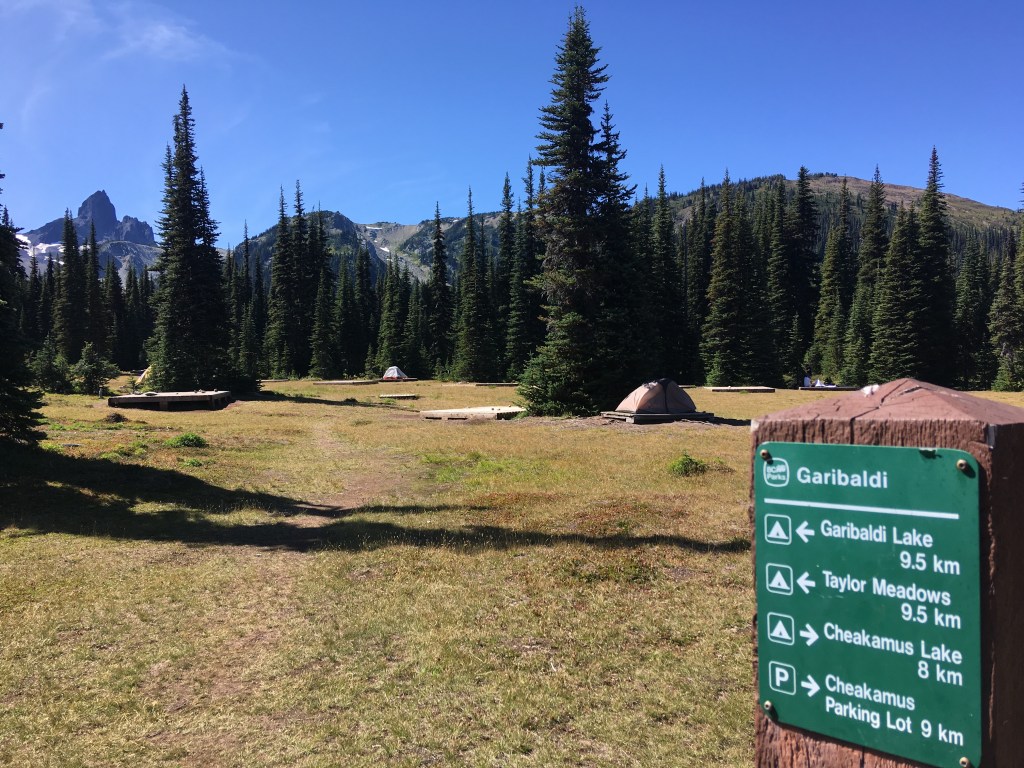
In 1.8km there will be a signed intersection. Turn right for Helm Creek Campground. Straight reveals Cheakamus Lake 3km from trailhead and Singing Creek Campground after skirting the lake for a further 4 km’s. This, 7km one way trail is bike friendly, has little elevation gain, and is a well maintained double-track trail meandering old growth forest.
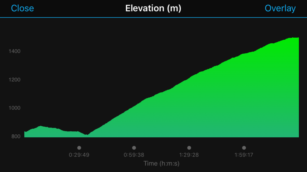
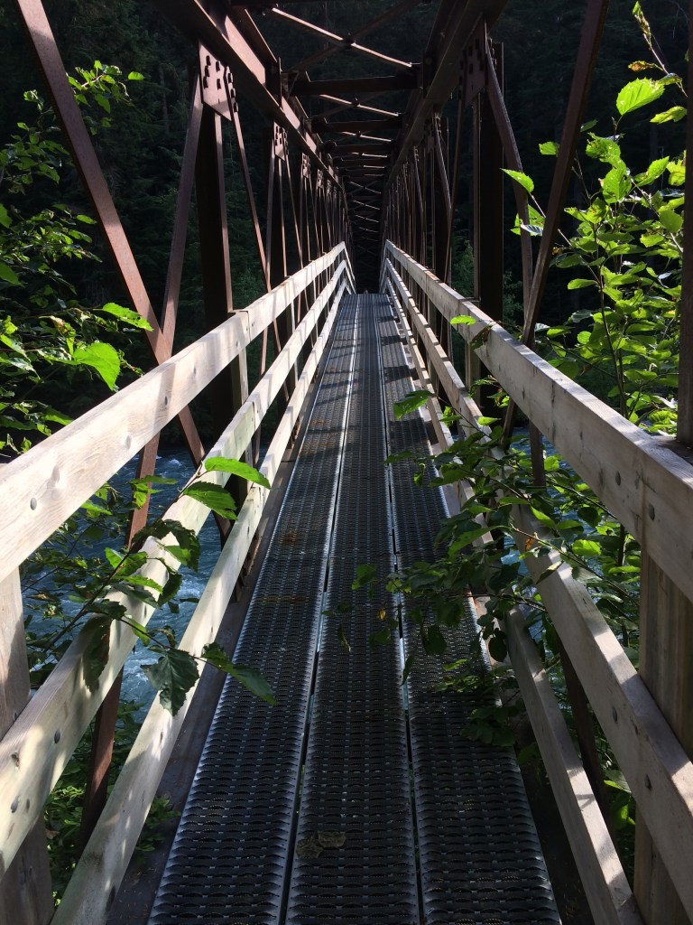
Turning R to access Helm Creek Campground means bikes are no longer welcomed. Dog’s are not permitted on either trail. Once you’ve crossed the bridge you’re just over 2km into your journey at 812m. From here the trail will climb unrelentingly through many switchbacks.
At the 4th switchback there is a fabulous rest option with a view 2.7km in at 960m. By the 10th switchback the grade has eased and the trail weaves a few more times before another solid rest option at 3.31km in at 1070m.
The trail continues to climb from here but at a progressively gentler grade. Water fill options also become progressively more frequent with better flow nearing the sub-alpine meadows preceding camp.
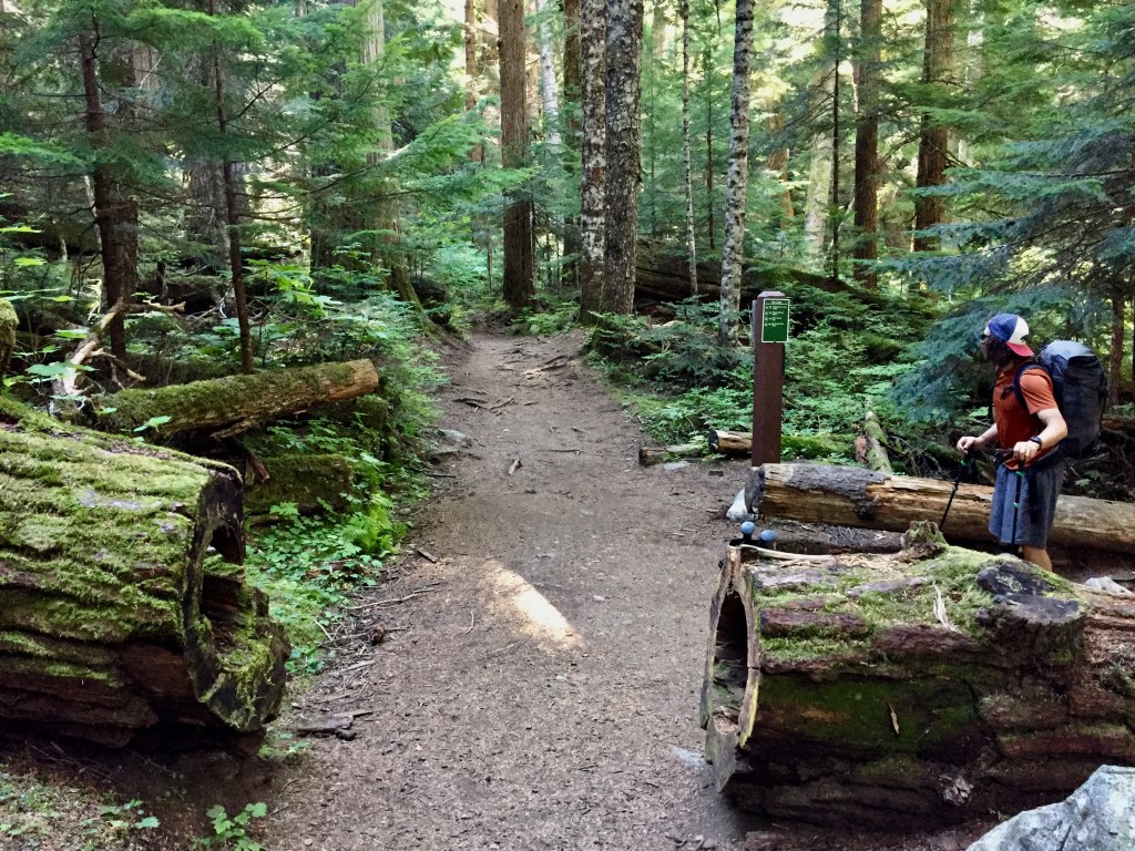
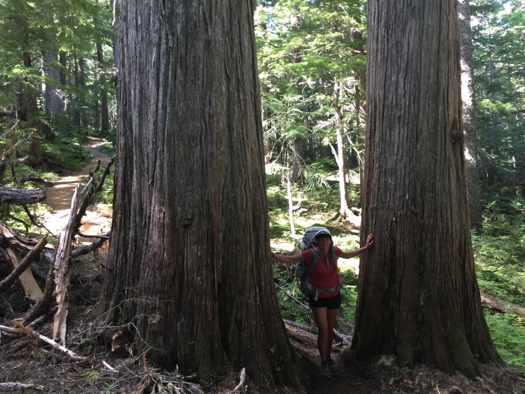
This trail is also a machine built, double-track trail which had a complete overhaul in 2015 and is in excellent condition. Only one notable blowdown causing a mild re-route through two impressive giants.
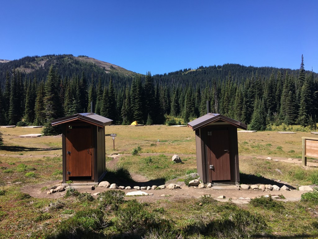
The campground has 30 wooden tent pads, two outhouses, good water supply (boil/treat) and options to hang your food on cables or stash in bear lockers. I’d recommend lockers if available as mice can tightrope on cables. Fires, motorized vehicles and pets are not permitted in Garibaldi Park. For more information or to make reservations go to:
https://discovercamping.ca/Garibaldi
*Also notable is the attention to water management on the 2015 re-build. Overbuilt ditching may be an eyesore but is great to see and a sign of building experience. Nature will inevitably shift, erode, and shed filling ditches/sumps and clogging culverts. Ditching is intended to catch/manage water preserving trail quality and more importantly controlling spread of sediment. Containment of sediment limits impact on waterways and nearby plant life. Failed ditching/sumps allows water to transport sediment freely to waterways negatively impacting aquatic plant/animal life with degraded water quality. Overbuilt ditching/sumps serve to mitigate this effect as well as preserve trail-side vegetation from getting buried and smothered by said deposits. In turn an elevated, unsaturated trail surface is more appealing for foot traffic thus limiting trail braiding potential and it’s detrimental impacts.
September 14th, 2019:
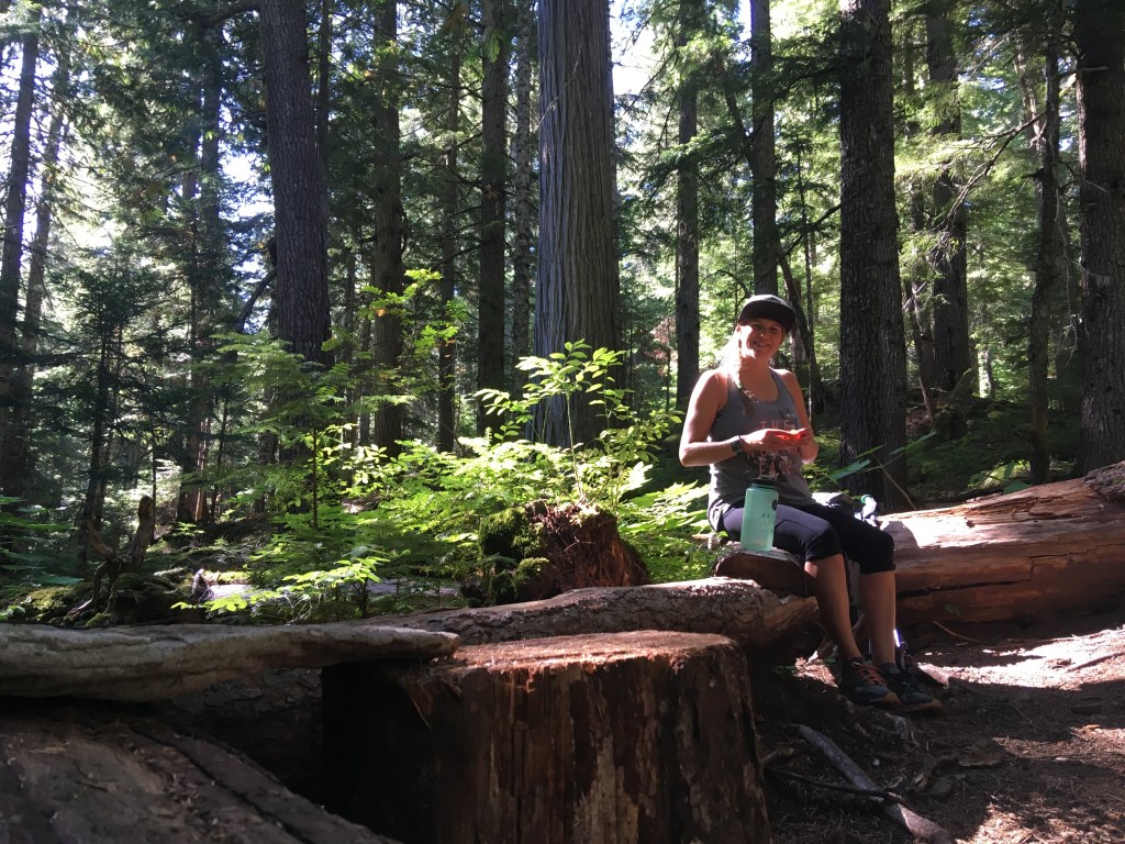
Crossing the Cheakamus River bridge is always enjoyable and we tend to hang out and soak in this zone every journey. Good sitting options on either side before many steep switchbacks. We drastically adjusted pace very shortly thereafter to compensate.
A highlight on the way up was two old-timers descending with ancient, huge! framed backpacks, modest clothes and killer spirits. A short while after there was a younger crew with a radio on an entirely different journey.
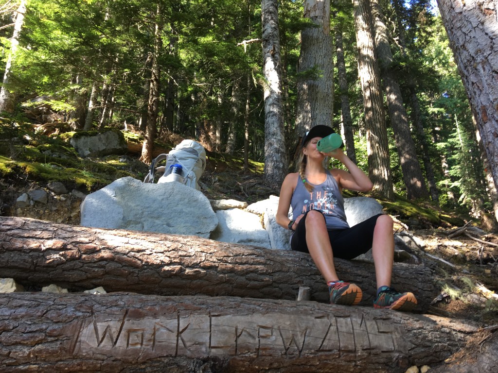
We did not travel with much water to help Gen carry less as she’s still lugging almost everything. We rationed slightly before topping up around a km before camp.
Arriving in camp we were surprised by how much busier this place had gotten since we last visited a few years ago. We were also surprised by our poor prep work when we realized we neglected to pack our oats for breakfast the following day. Such is life, more rationing.
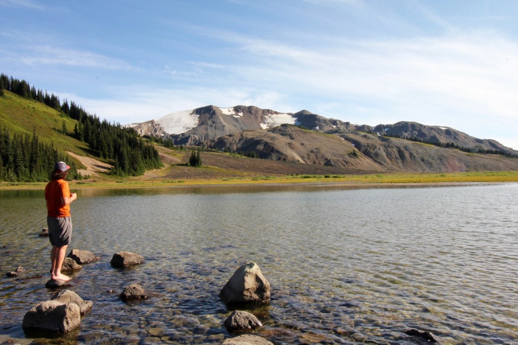
We set up camp, ate, and left hoping the mild cinder flats up to scenic helm lake would grant us passage. My knee co-operated after a solid rest/elevate, stretch/manipulate session and we made it the further 4 km to helm lake. This is where the appropriate nickname “desolation valley” becomes obvious. Its somewhat like being on the barren moon but where vegetation is just barely taking hold.
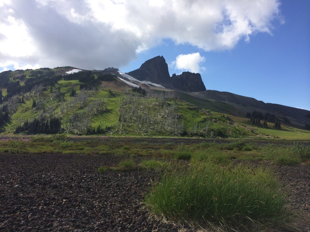
The Cinder flats or “desolation valley” continues to lie subject to Cinder Cone. After the last glacial period in geologic time this mountain erupted spewing a 9km long lava flow. Currently pyroclastics which wind and water carry down still shape the valley.
Both ascending and descending the flats we saw a healthy looking black bear foraging trailside. Nice to see this area can support such a large omnivore. Enroute up there was ample space for separation but we made our presence clear to avoid surprise. I chose to be less assertive as there was a significant buffer in an attempt to displace as little as possible. This proved effective evident by a head turn and a slight adjustment of foraging direction. (Indication this bear is intent on preserving a healthy safety bubble and avoiding human contact. A human habituated bear will have a shrunken bubble thus allowing humans to get too close. This means when human presence crosses the bubble boundary at a shorter distance it is increasingly likely the reaction to a perceived threat may be fight to survive, instead of flight.)
Arriving back to camp just as the sky was putting on a show was great and dinner quickly followed.
The following morning we slowly broke camp. We’re big on drying out gear as much as possible before packaging to extend life and cut weight. It was neat to see our younger neighbors following suit and I wondered if this was co-incidence. A short while later one member approached us to ask for help with their new stove. Suspicion confirmed and I was happy to share knowledge understanding gear can be finicky. Asking for help is rad and within an outdoor community you can count on a positive experience. Everybody knew nothing at some point and we should all remember that.
Keep stoking the fire.
