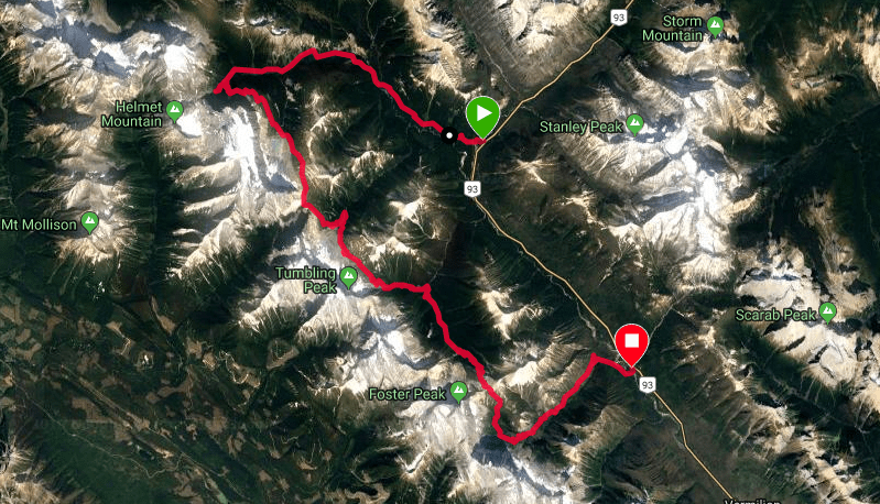
Start: Paint Pots Trailhead
Campgrounds: Helmet, Tumbling Creek, Numa Creek, Floe Lake
Finish: Floe Lake Trailhead
Route: Rockwall Trail
Distance: 55+ km through-hike
Elevation Gain: 2600+ m
Notables: Expect hiking distances to be underestimated. Reportedly as short as 55km in its entirety we had multiple reliable GPS devices which all reached larger estimations even considering detours. The resulting 55+ estimate is likely more telling.
That being said, travel is generally quick and easy on moderate gradients and a well defined trail. Weather, fitness requirements due to distances or muddy surface condition in a trenched trail are your most likely challenges. Consider gators for mud.
Consider mid July-early October but research into weather patterns also encouraged due to average elevation on the majority of the trail and multiple mountain passes well over 2000m.
Availability will obviously influence your route but considering the value of scenery at Floe lake and the substantial climb below it most aim to start at Paint Pots and exit Floe. All the Campgrounds are resourced with ample bear caches, pit-toilets and tent pads. Running water can also be expected at each campground and plenty more trail-side options throughout.
A very sought-after objective, consider making reservations well in advance at:
https://www.pc.gc.ca/en/pn-np/bc/kootenay/activ/arrierepays-backcountry
September 9-13.
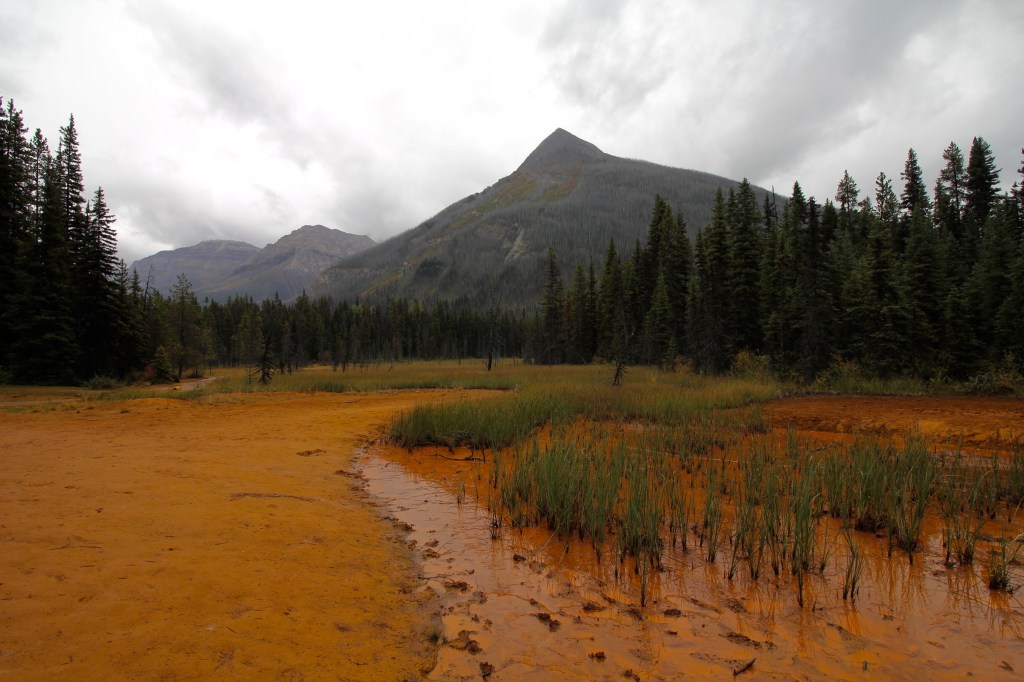
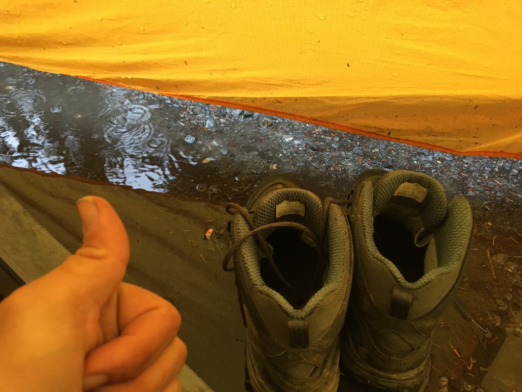
Started at Paint Pots trailhead in a light rain checking out the historically significant Ochre beds. The weather would remain fairly consistently wet with the odd break and the odd steadier shower which fell as light hail on the passes.
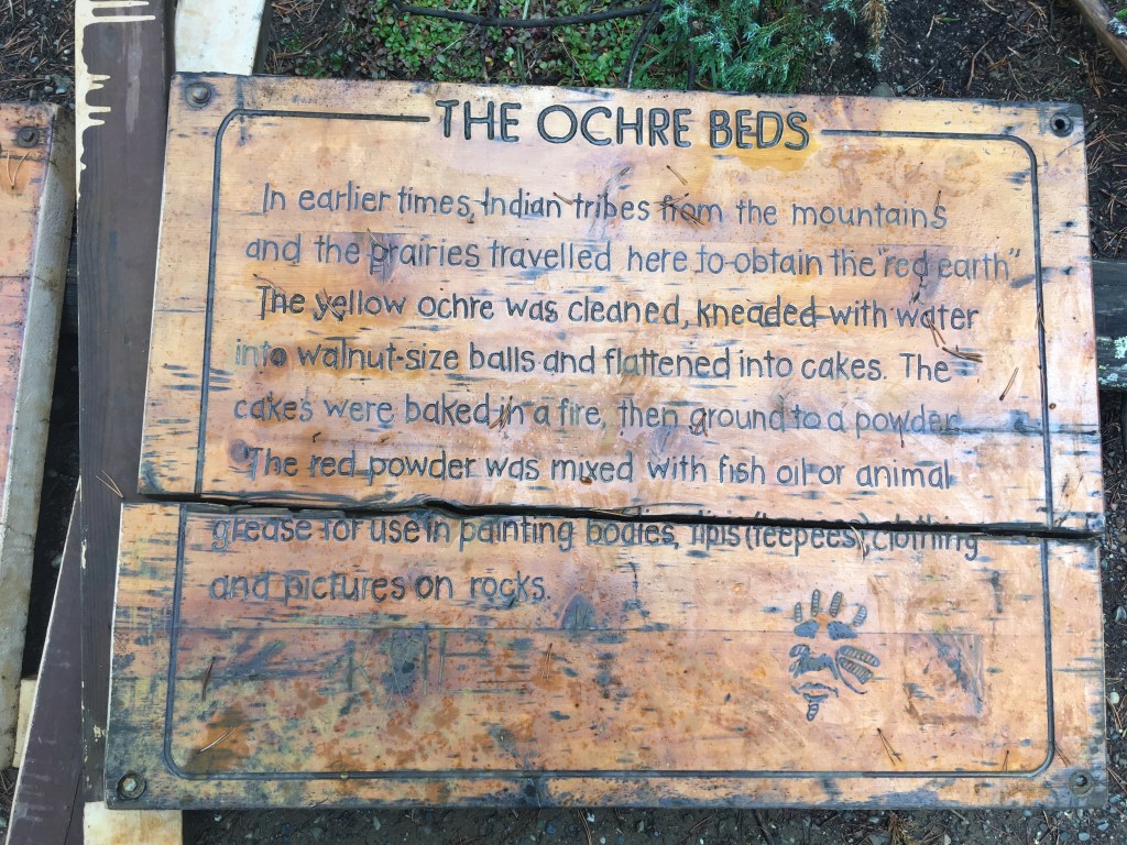
From Paint Pots the traffic is immediately busiest as the Ochre beds are not too far from the HWY so many have a chance to take a look. It’s also mucky but the visuals are unique and distracting.
A very gradually uphill gradient which only gains a few hundred m over 15+ km’s. Longest and easiest day.
One river crossing in particular was especially unique and guarded a riverside pebble beach rest option we all enjoyed.
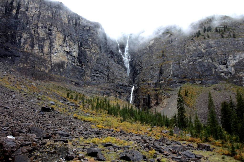
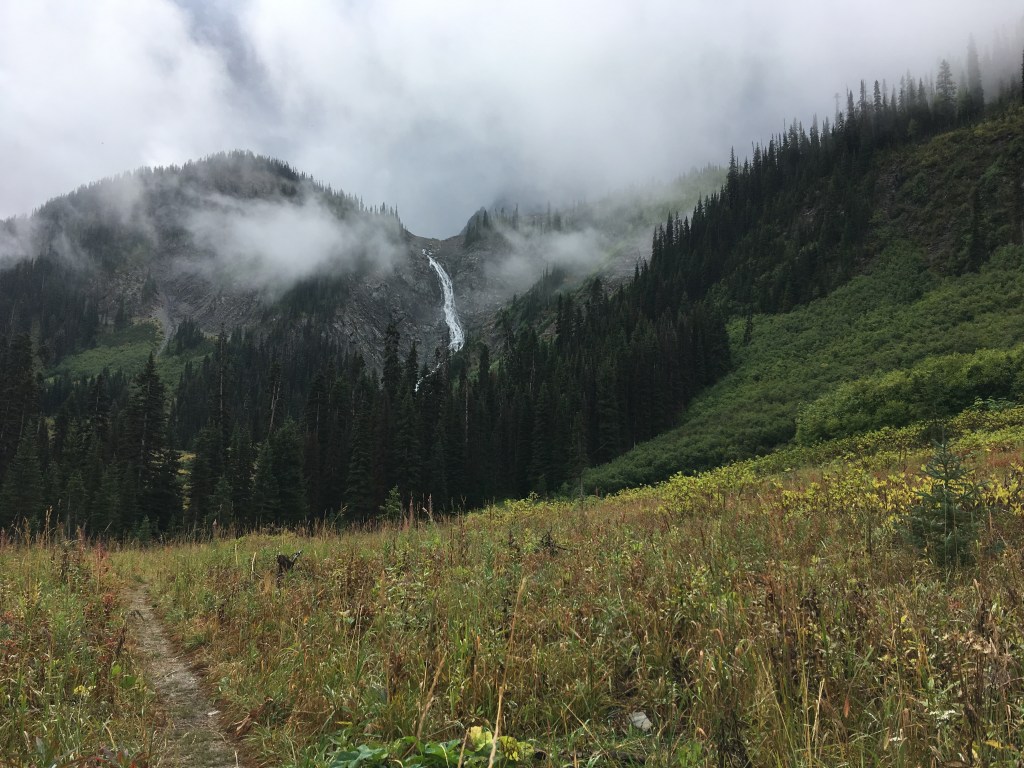
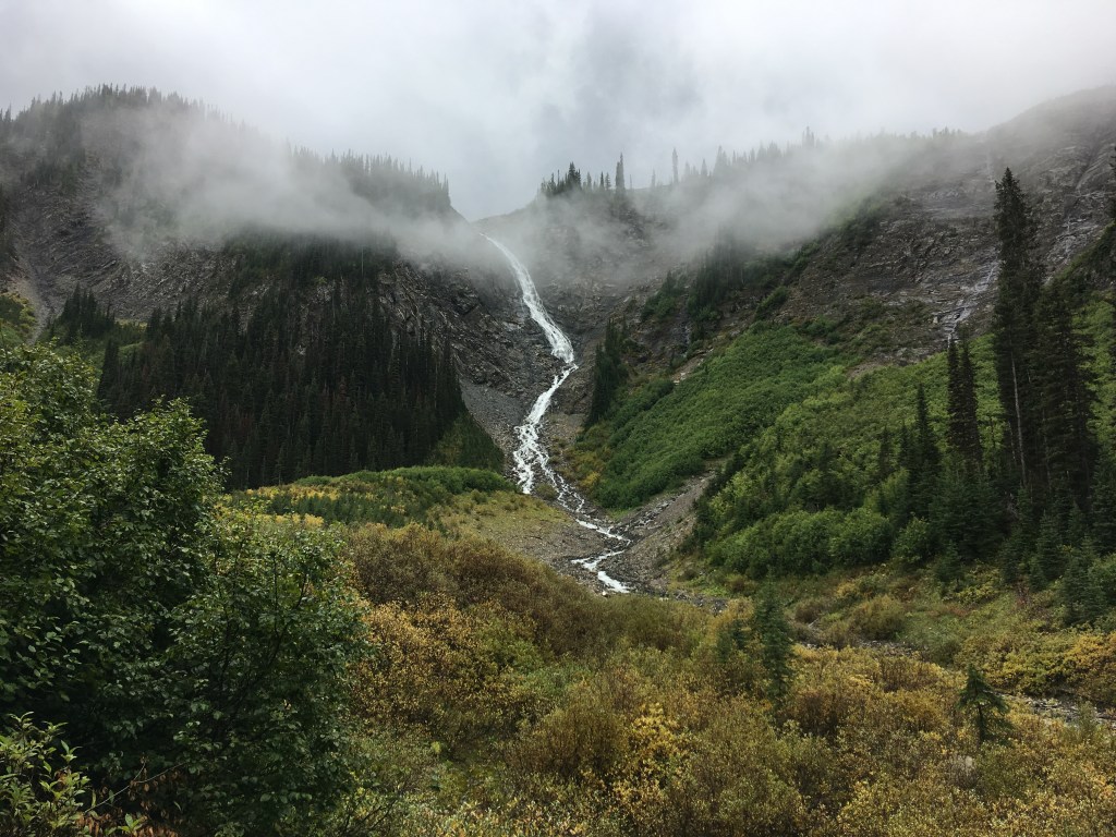
Nearing Helmet falls spirits were high as our objective was in sight.
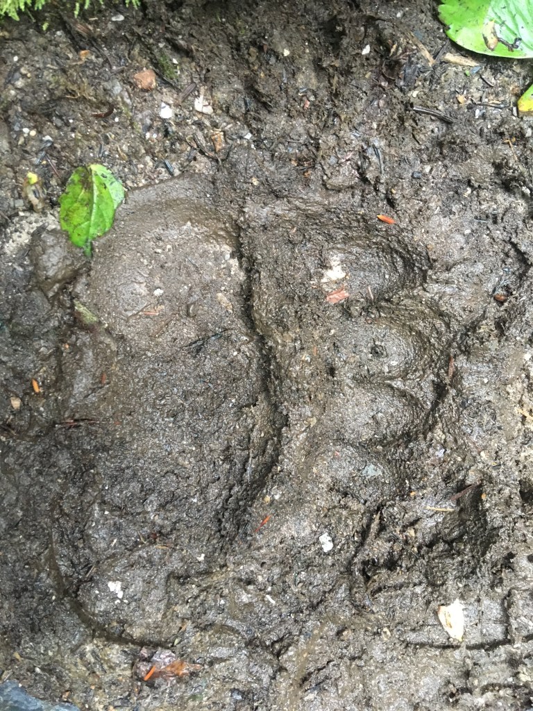
It appeared there was another hiker enjoying the trail network as well. Grizzly tracks were headed in both directions and reported sightings from the group in front of us after arriving at Helmet Falls Campground.
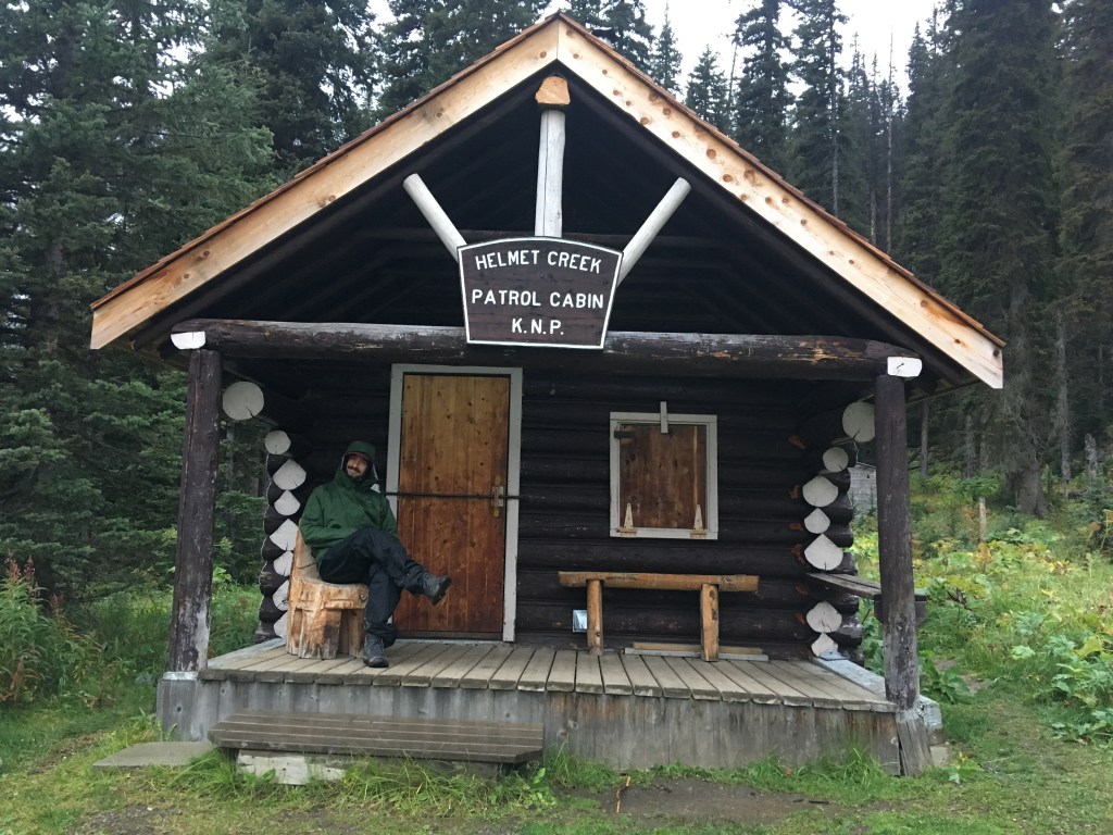
Arrived to camp late which would be our style throughout due to my slower post-op pace. Took a nice sit by the river enjoying some canopy shelter with Gen before a late dinner and bed.
Patrol cabin here but there was no sheriff on duty so we filled in.
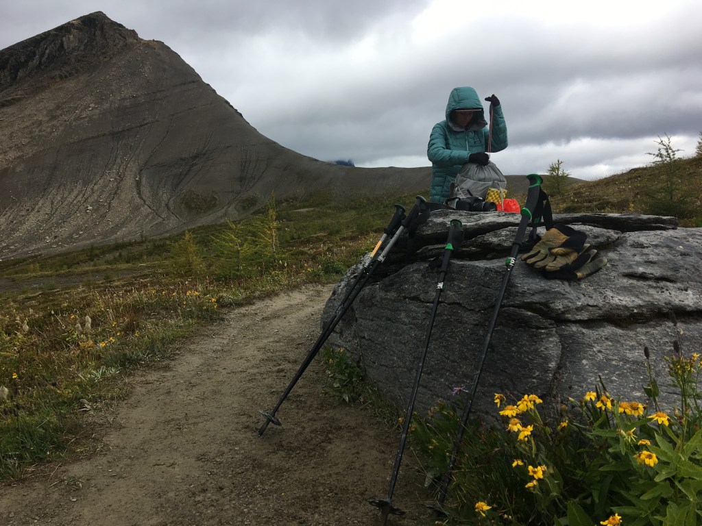
Awoke to see a fresh dusting in the high country. With forecast-ed temperatures remaining low we took time to air our tent and were pleased we had made efforts to keep our gear dry.
Opted to take the short detour towards the base of Helmet falls after breaking camp. This minor addition is well worthy.
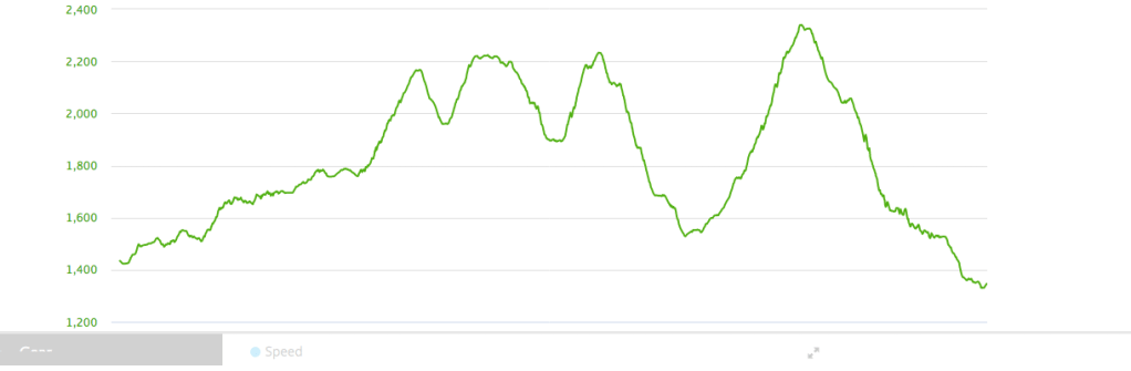
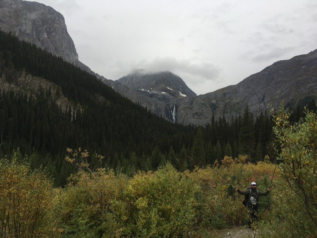
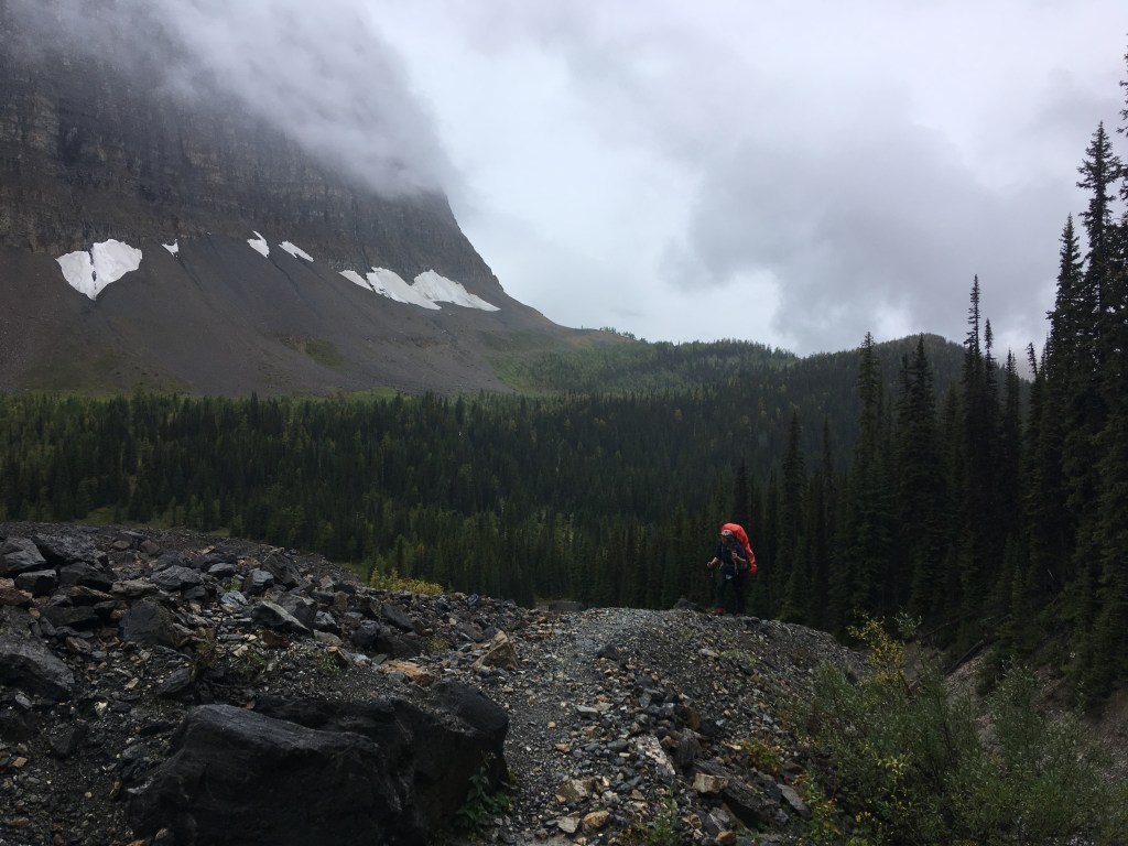
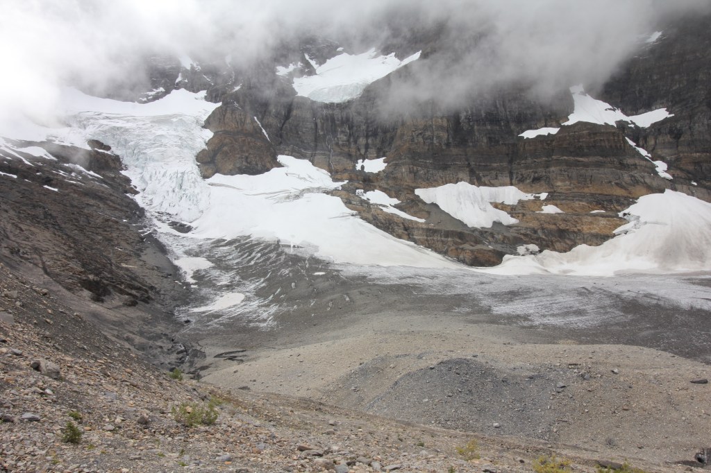
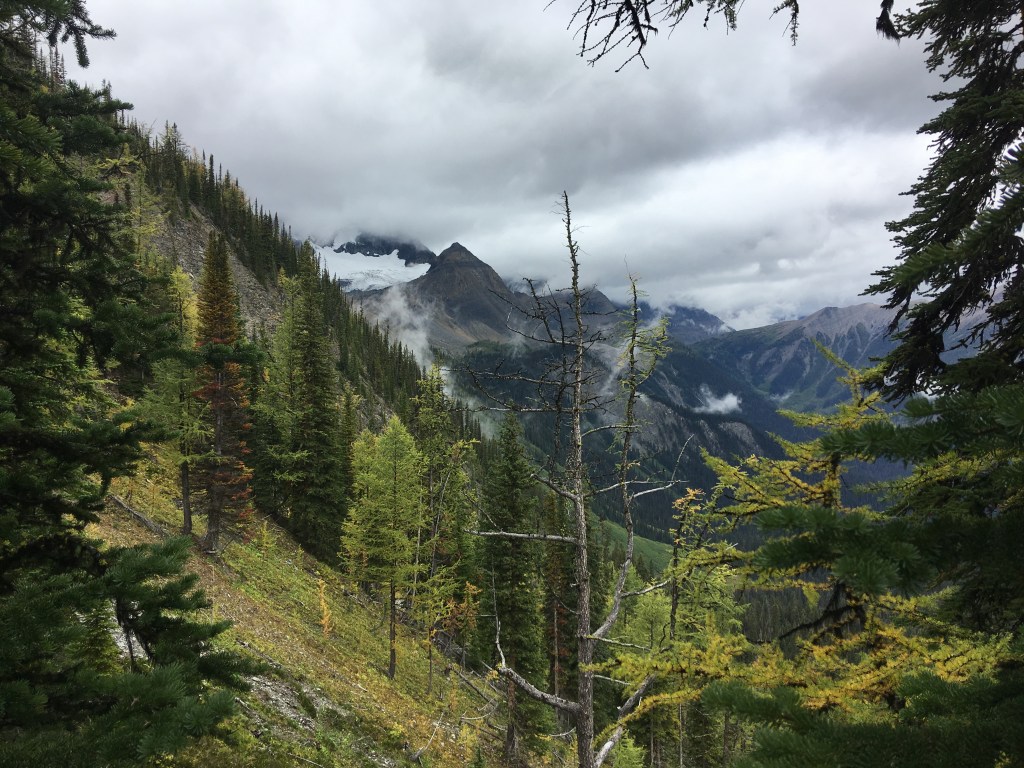
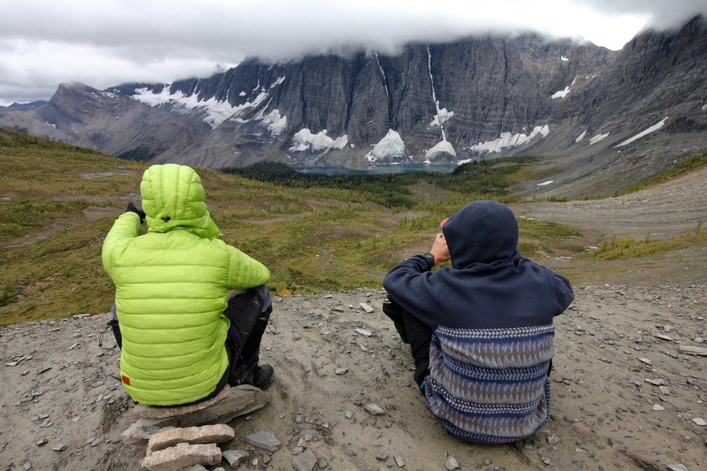
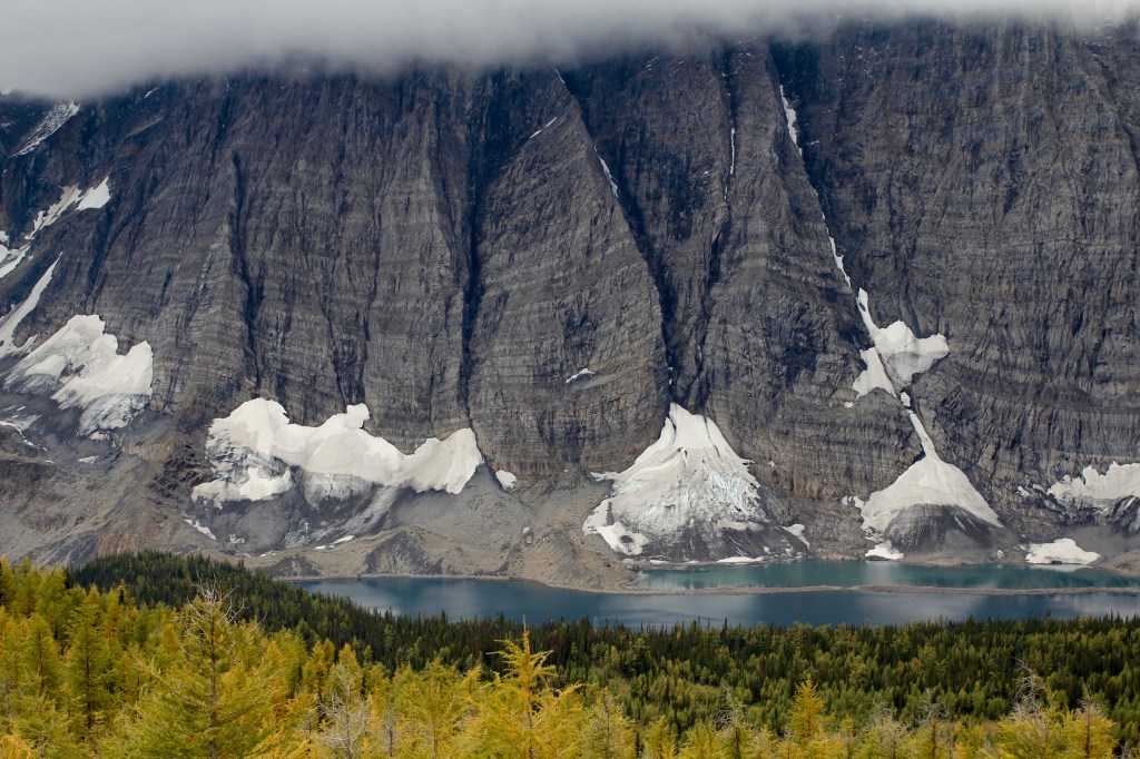
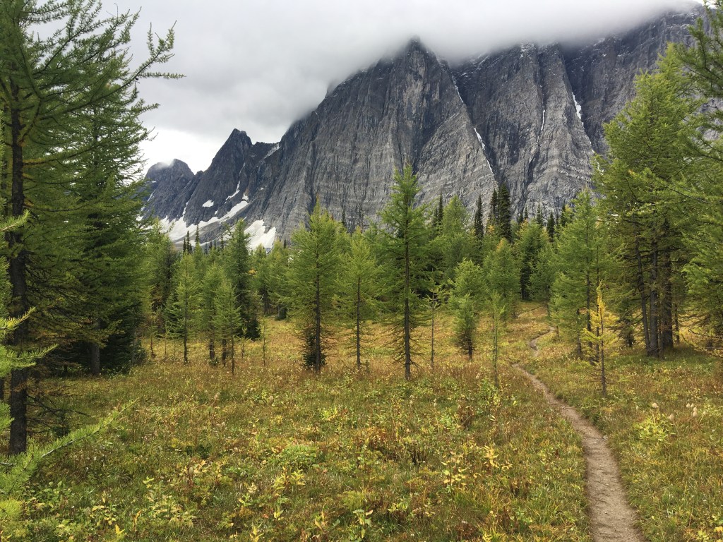
The first of 3 mountain passes comes next skirting Limestone Peak and climbing over 2200m at Rockwall Pass.
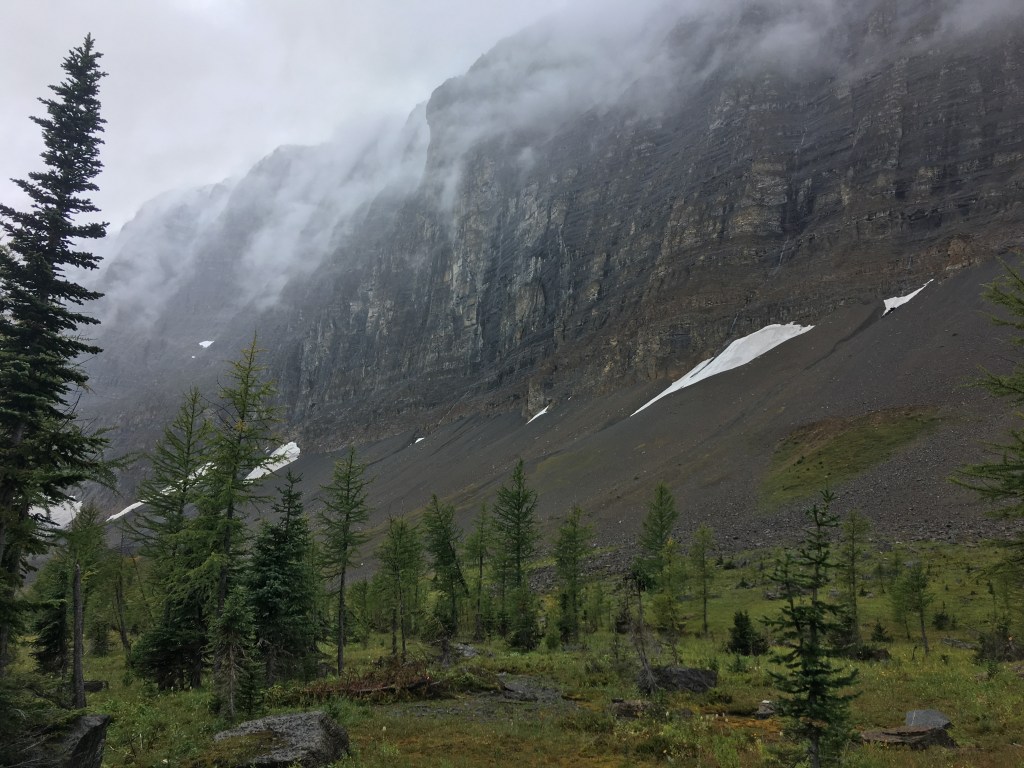
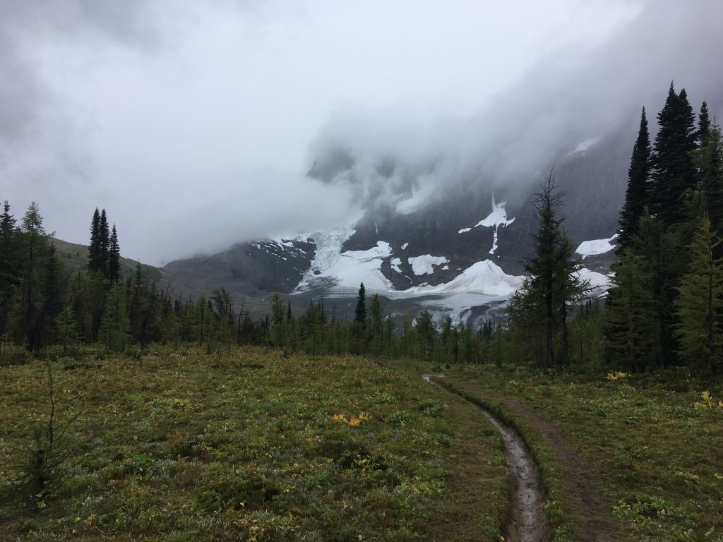
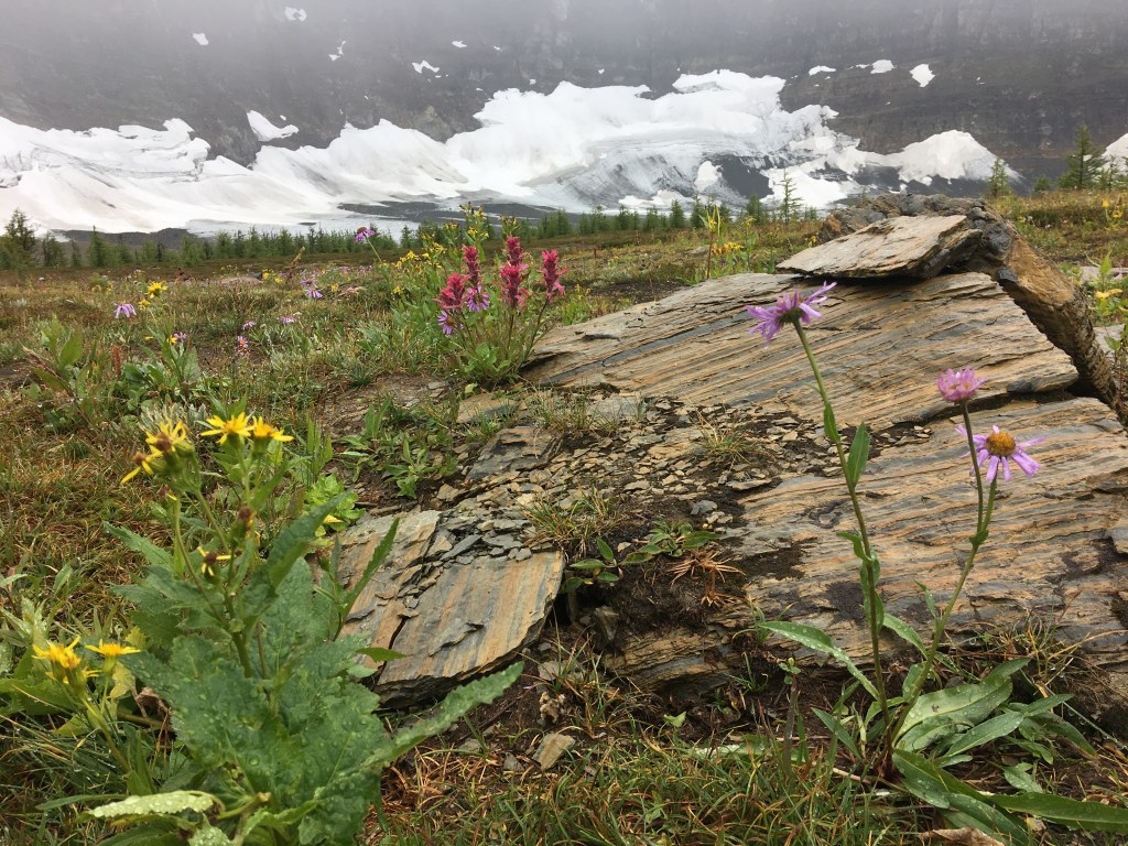
Alpine scenery here is phenomenal (even in the rain) as the Rockwall begins to reveal its vertical rise and imposing scale.
Lush forest, glaciers, wildflowers and Larch trees beginning to change colour add to the visual buffet and make good excuses not to descend to Tumbling Creek Campground.
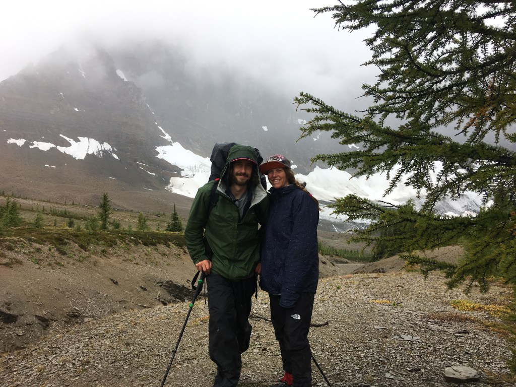
We bumped into a friendly couple also procrastinating the descent and took turns taking photos of each other. Another solid excuse to stay.
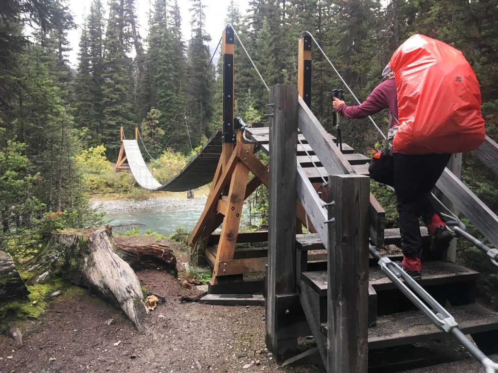
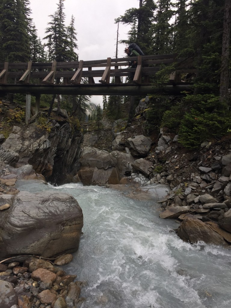
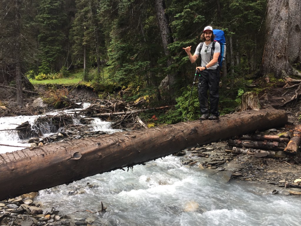
Leaving the campground it was obvious you could ford the river as a shortcut but little distance can be gained here and you would miss another superb bridge.
Just under 350m to gain to Tumbling pass before more than 700m of descending to Numa Creek Campground.
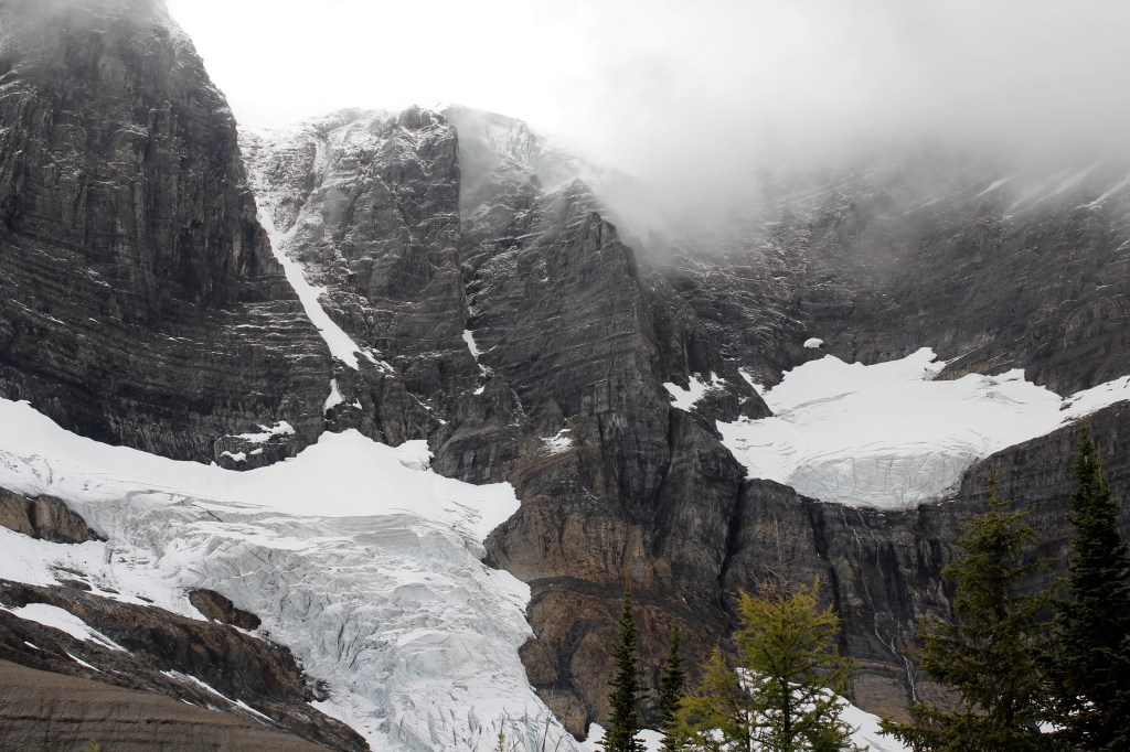
The ascent parallels a moraine which guards a portion of the views, especially with low cloud cover. We opted for a short detour to crest the moraine nearing its high point and were not disappointed.
After moving on the clouds lifted slightly for a short while and we got an even better glimpse of Tumbling Glacier.
This descent to Numa creek was the hardest part of the trip for me. Even with poles and a lighter pack my knee struggles significantly downhill. Heavy reliance on poles, moving slow, decisively, and often backwards as well as suffering are still my go to strategies. Gen was again a total gem in the patience, understanding, and carrying everything departments.
As the descent eased and we neared camp, a drizzle turned to steady rain just as we entered a stand of huge old growth. We took shelter under a giant on a dry log and timed the showers break superbly after a longer rest and a bit of wine.
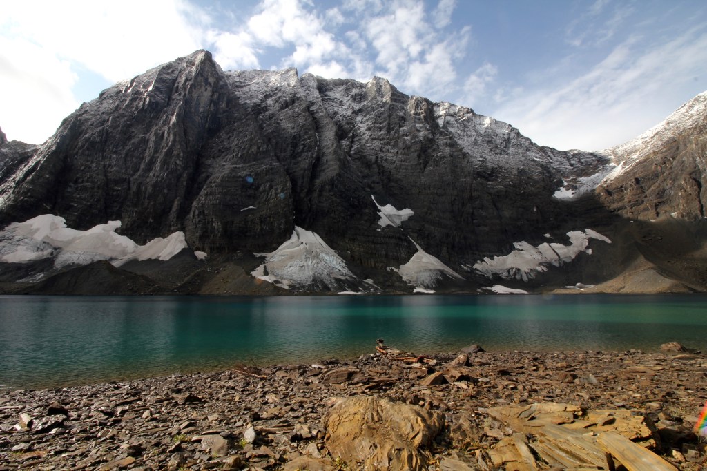
Day 4 and around 800m of climbing to Numa Pass with a reveal of Floe Lake and stunning views in all directions.
The trail climbs from Numa creek but at a lower grade and eases flat before Numa Falls.
A sketchy, wet, crooked log or a river ford are in store before the falls. Best views of the falls are after the river crossing and just before the switchbacks climbing towards Numa Pass.
Good rest opportunity just past the crossing with quality creek-side atmosphere and Numa falls as a backdrop.
More lush forest to ascend before the canopy gradually thins approaching the alpine granting improving landscapes
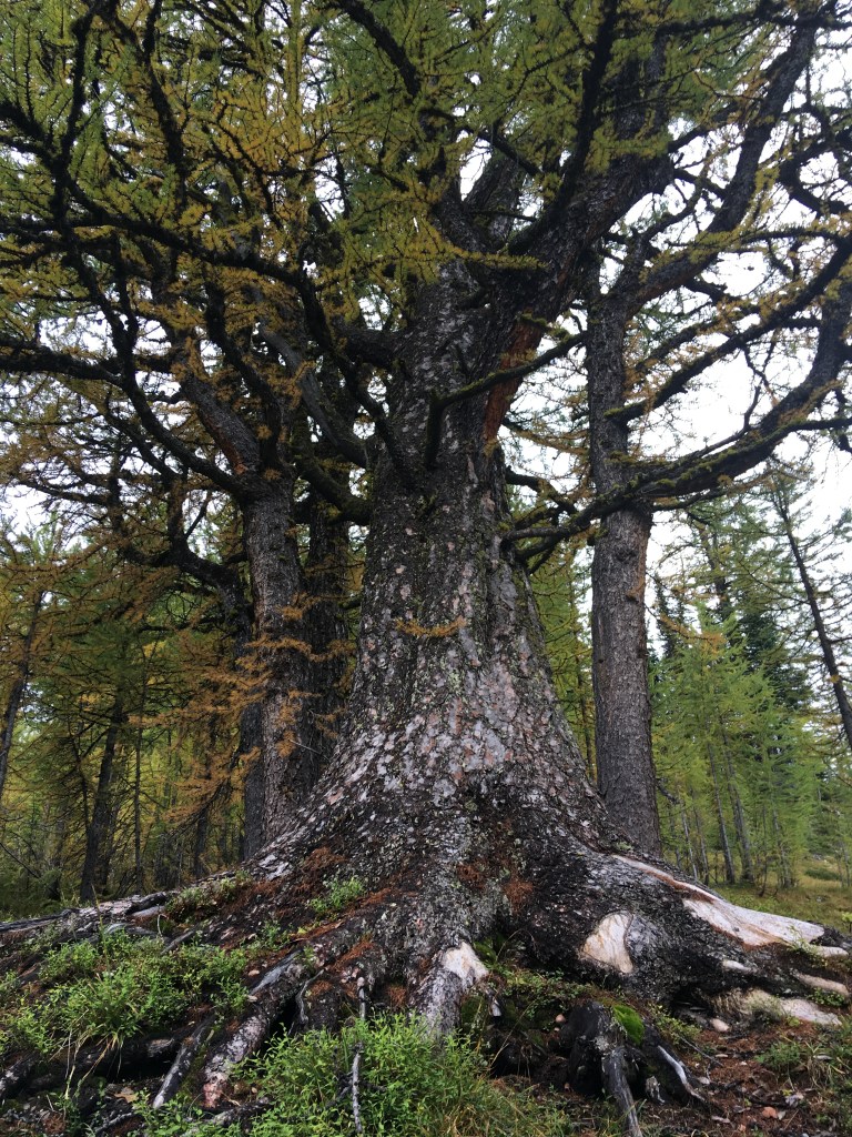
A very impressive Larch specimen nearing the pass and truly sensational views.
We took our time nearing the pass. Having trouble making progress with so much to see.
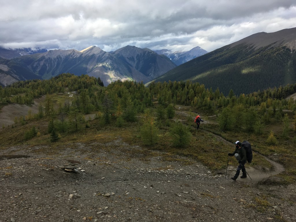
Our best weather yet on this pass and once again hung out up there for quite a while.
There is a fabulous looking scree ramp scramble option to a sub-peak with easy access from the pass. We spent enough time soaking in the views to have rambled up but thought better of it with a post op knee. Making the right decision can be tough but in this instance rather than paying for a scramble I was rewarded with a knee that would later tolerate a walk around Floe to a very scenic sunset dinner location. Fair trade.
The descent to Floe yielded ever improving views of the lake and the rock wall which is Floe Mountain.
Easier terrain than anticipated descending. The lake lies over 2000m so also not as much elevation to lose.
We arrived to Floe before sunset and walked up the N shoreline for a lakeside dinner. This was a solid option to improve an already awesome view.
Heavy rain on our final night/early morning but it cleared for a lakeside breakfast and only sprinkled intermittently enroute down.
The rain fell as snow above the lake adding to breakfast vista’s and letting us see this place in a new light.
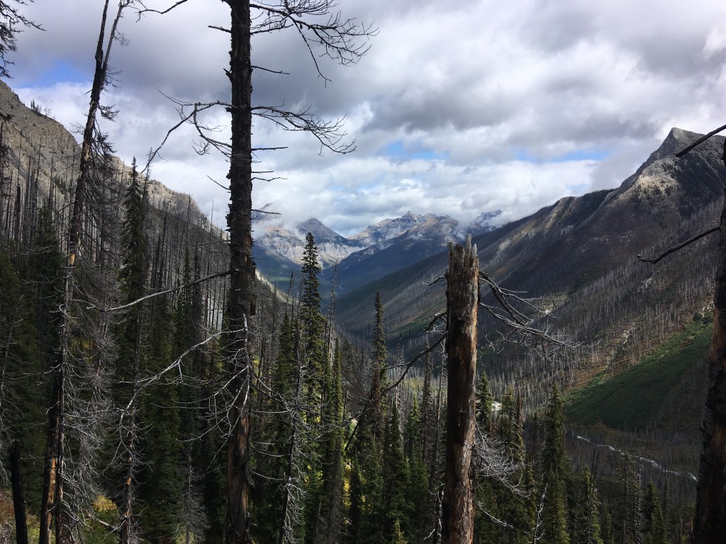
Around 700m in elevation loss from the lake to Floe trailhead. The steeper portion switches back just below the lake before a long mellow traverse out the valley draining Floe S of Numa.
A huge burn swept through this zone in 2003 making for superb new growth potential and dramatic landscapes. The lack of shade and fewer water options on this leg could be an issue in hot/sunny conditions.
Also delicious raspberries. Total icing on an already phenomenal cake!
